Home

TTR News Center

TTR Weather Update from NWS Austin – San Antonio. Includes information for Caldwell, De Witt, Fayette, Gonzales, Karnes, and Lavaca Counties.

No Comments Local News

…Locally Heavy Rainfall Possible Sunday Night…

…Strong Storms Possible Sunday Afternoon and Sunday Night…

Timing and Area of Concern:

  • Heavy Rainfall:  Primarily near and east of Interstate 35 and I-37 Sunday Night, including Austin metro.
  • Strong to Severe Storms:  Hill Country and along and east of I-35 Sunday afternoon and Sunday Night.

Threats & Impacts:

Rainfall:  1-2 inches with isolated amounts over 4 inches near and east of I-35 and I-37, including the Austin metro area. Around 1 inch over the San Antonio metro area is expected. Less than 1 inch farther west of I-35 and I-37. Please reference overview and confidence sections below for uncertainty.

  • Some locations could experience minor flooding with flood waters capable of causing small streams, creeks, canals, and ditches to become swollen and overflow in a few places. Flood waters may prompt brief closures of low water crossings. Some river points along the Lower Guadalupe River could experience minor flooding. Other mainstem river basins east of I-35 in South Central Texas could see points in action stage.

Hail: Up to 1 inch in diameter

Winds: Up to 60 mph

Overview:

A strong upper level disturbance will move across the region Sunday afternoon and Sunday night. Showers will form Sunday morning with scattered thunderstorms possible Sunday afternoon. The showers and storms will become more widespread Sunday evening from the eastern Hill Country through the I-35 corridor and then transition east of I-35 overnight Sunday into Monday. The greatest potential for heavy rainfall looks to occur near and east of I-35 and I-37 where 1-2 inches of rain with isolated amounts over 4 inches will be possible. The threat for heavy rainfall will move east into Southeast and East Texas Monday morning.

There will also be be a threat some storms could become strong to marginally severe Sunday afternoon and Sunday night. Any of these storms will be capable of producing small hail and damaging straight-line wind gusts.

Confidence:

Low to moderate on exact placement of heavy rainfall corridor across Texas. There is still some uncertainty that heavier rainfall amounts could be pulled into and just west of the I-35 corridor, including the cities of San Antonio and Austin. Please monitor forecasts closely through the holiday weekend for any potential westward shift in heavier rainfall into the I-35 corridor and eastern Hill Country.

Sun-Mon Threats

Additional Information Resources:

Sincerely,
Jason Runyen

NWS Austin / San Antonio

Weather Forecast Office
2090 Airport Road
New Braunfels, TX 78130

TTR Weather Update from NWS Houston-Galveston. Includes information for Colorado, Jackson, and Wharton Counties.

No Comments Local News

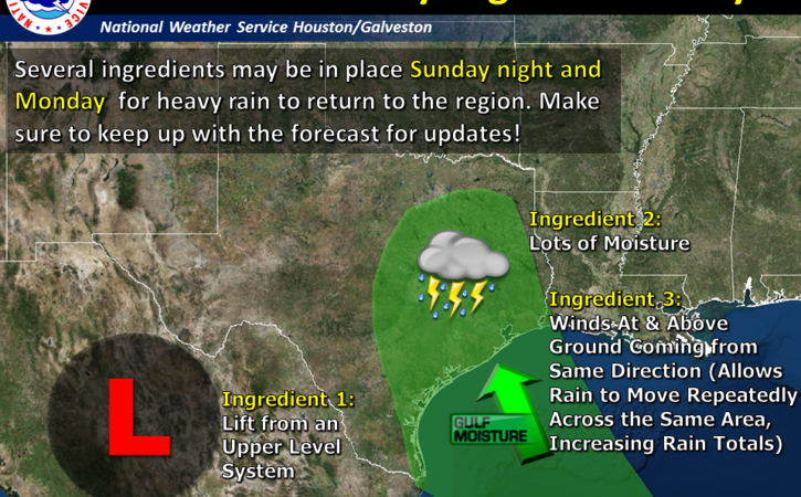
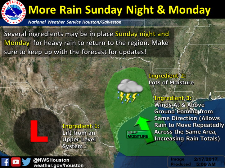
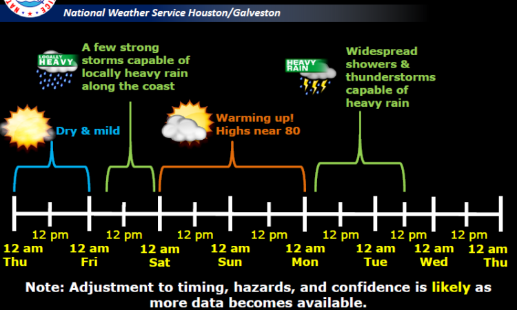
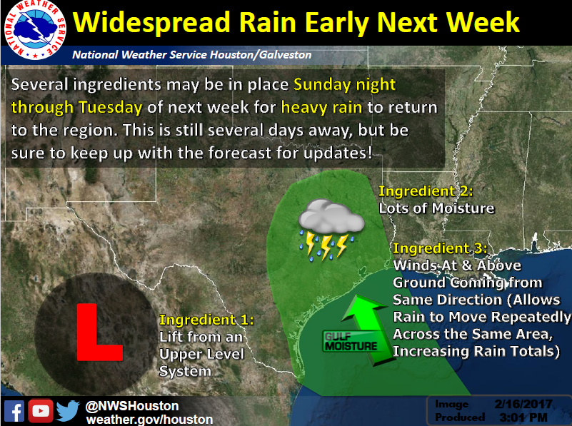
A strong storm system will approach the area Sunday night. This system will bring periods of showers and thunderstorms. Some of the rain could be heavy Sunday night into Monday morning.


Changes:
Timing has changed. The system remains progressive and showers and thunderstorms could start as early as mid Sunday afternoon with a bulk of the rainfall occurring Sunday night into early Monday morning.

What: Heavy rain event with some potential for excessive rain that could lead to flooding.

Where: All of Southeast Texas but latest model consensus is focusing the heavier rain north and east of the Houston metro area.

When: The potential for heavy rain is greatest Sunday night into early Monday.

Primary Hazard:  Heavy rain/flooding.

Secondary Hazard:   Frequent lightning.

Confidence:  Moderate.  Timing differences between models and now some significant differences between the models on the geographic placement of the highest rainfall.

image4

Links

NWS Houston/Galveston Webpage: www.weather.gov/houston

West Gulf River Forecast Center: https://www.weather.gov/wgrfc/

AHPS Webpage: https://water.weather.gov/ahps2/index.php?wfo=hgx


Charles Roeseler and Paul Lewis
NWS Houston – Galveston

TTR Weather Update from NWS Corpus Christi. Includes information for Calhoun, Goliad, and Victoria Counties, Victoria Crossroads, and Coastal Bend.

No Comments Local News

…Heavy Rainfall Event Possible Sunday Night through Monday…

Timing and Overview:

Atmospheric conditions are expected to become favorable for the development of a heavy rainfall event Sunday Night through Monday Afternoon primarily over the Coastal Bend and Victoria Crossroads regions of South Texas.
South Texas Impacts:

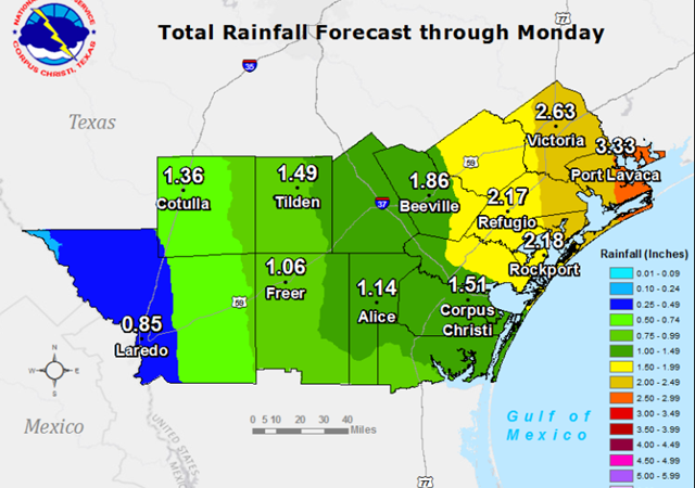
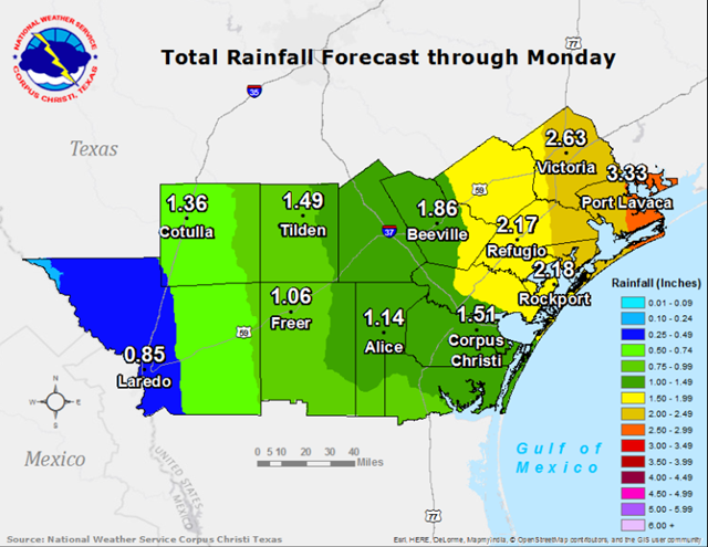
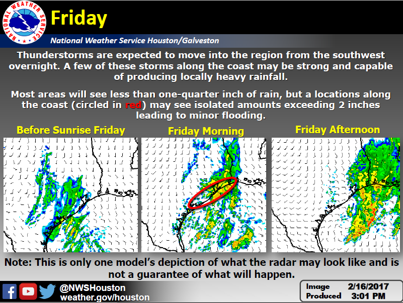
Rainfall: Currently, rainfall amounts of 2 to 3 inches with isolated 4 to 6 inches are anticipated for the northern Coastal Bend and over the Victoria Crossroads for the period Sunday through Monday. Up to an inch of rainfall has fallen over portions of the northern Coastal Bend and Victoria Crossroads this Friday morning. The combination of additional rainfall Sunday and Monday may contribute to flash flooding over portions of the northern Coastal Bend and Victoria Crossroads.

1

Additional Information Resources:

NWS Corpus Christi Webpage:  www.weather.gov/corpuschristi
Online Flood Reporting:  www.srh.noaa.gov/StormReport/SubmitReport.php?site=crp
AHPS River Forecastswater.weather.gov/ahps2/index.php?wfo=crp

Sincerely,
Waylon Collins
NWS Corpus Christi, TX

TTR Weather Update for Colorado, Jackson, and Wharton Counties from NWS Houston-Galveston

No Comments Local News

The National Weather Service in Houston-Galveston continuing to monitor the potential for heavy rainfall and flooding Sunday night through Monday.

Bottom Line: We are still concerned for 1) Heavy rainfall and 2) small threat of strong/severe storms Monday.

2

3
4
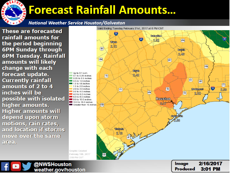
These are 2 day rainfall totals forecasted from 6PM Sunday to 6PM Tuesday. While the forecasted rainfall totals will likely change the next couple of days leading into the weekend, rainfall amounts of 2 to 4 inches of rain looks reasonable for much of the area. There will be isolated higher amounts but those will depend on details like storm motions and rainfall rates on smaller scales. Overall timing of the event looks on track.

Confidence:

Timing: medium to high confidence on Monday time frame for heavy rainfall and strong/severe storms.

Forecasted rainfall amounts: low to medium confidence on amounts. Medium to high confidence that it will rain.

Location: low to medium especially for isolated higher amounts of rainfall.

Impacts: medium confidence that if 4 inches or more of rain are realized there will be impacts to area rivers and bayous that could lead to flooding. Flash flooding may be possible.

Links:

NWS Houston/Galveston Webpage: www.weather.gov/houston

West Gulf River Forecast Center: https://www.weather.gov/wgrfc/

AHPS Webpage: https://water.weather.gov/ahps2/index.php?wfo=hgx

Scott Overpeck, Katie Landry, Wendy Wong
National Weather Service
Houston – Galveston