Home

TTR News Center

Tropical Depression Harvey Update from NWS Corpus Christi includes information for CALHOUN, GOLIAD, and VICTORIA Counties, Victoria Crossroads, Mid-Coast, Coastal Bend, and Brush Country – Greatest Concern is Heavy Rain/Flood Potential!

No Comments Local News

Good Evening,

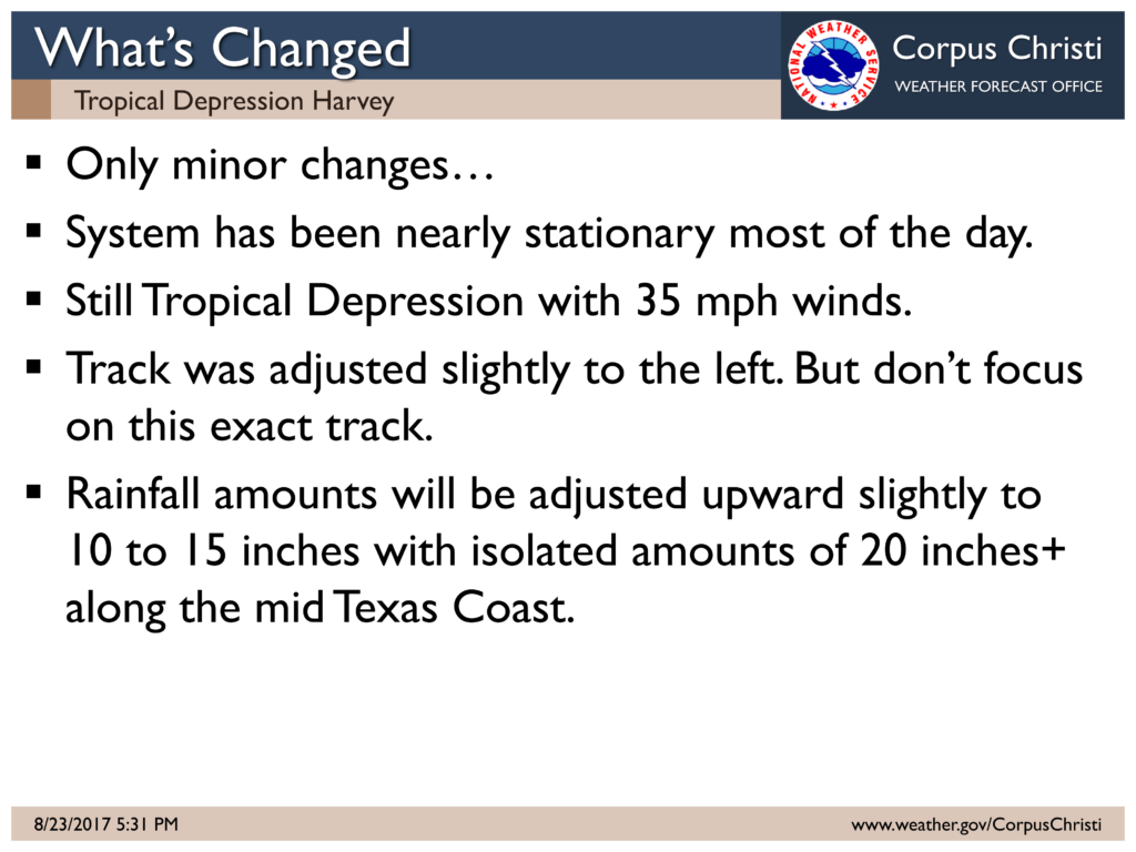
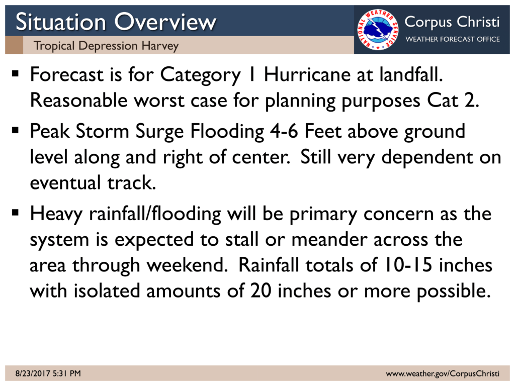
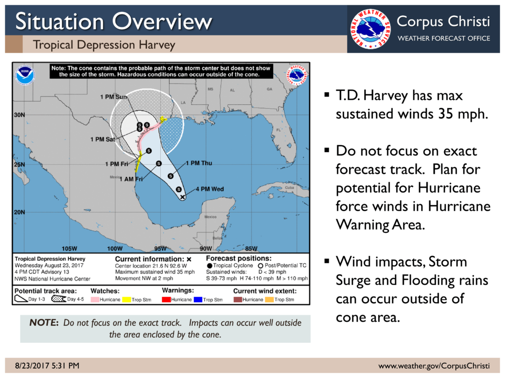
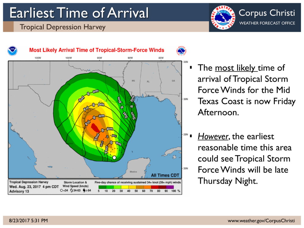
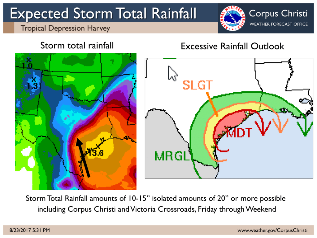
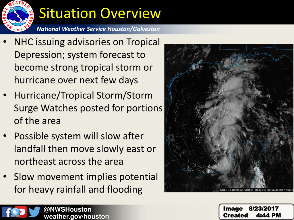
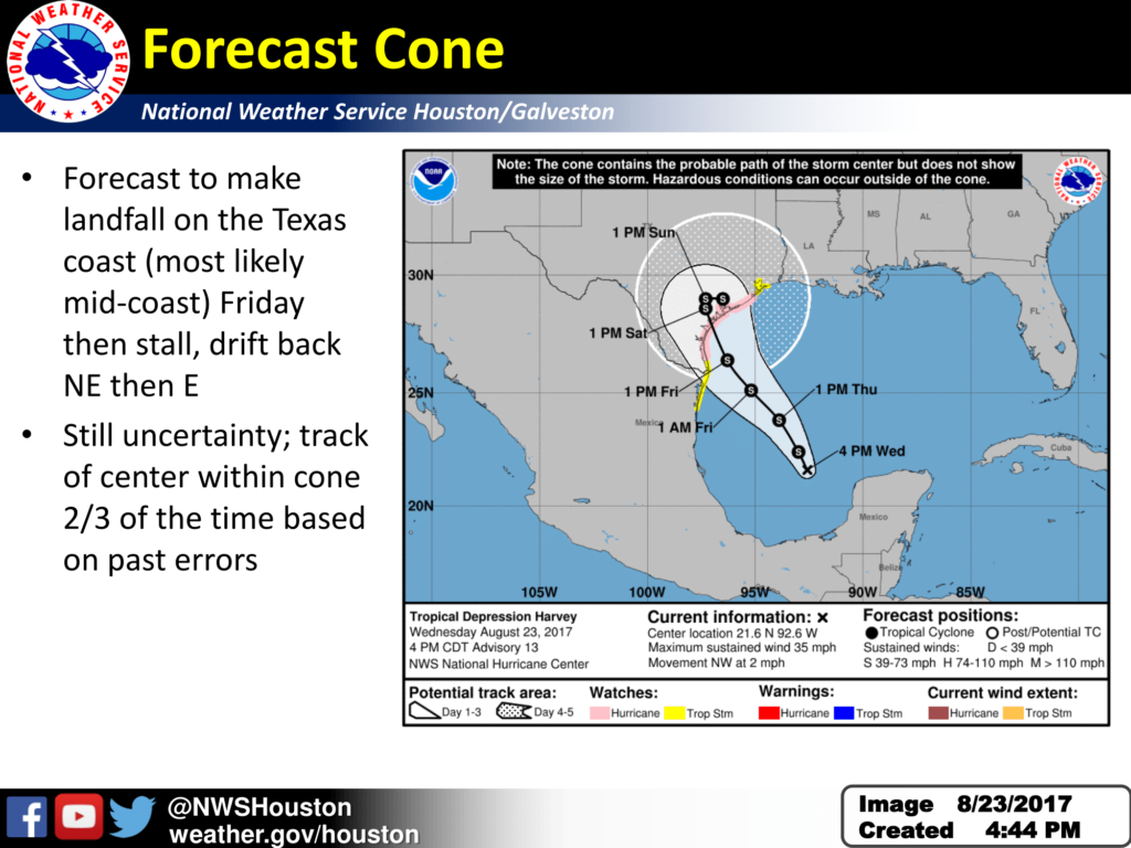
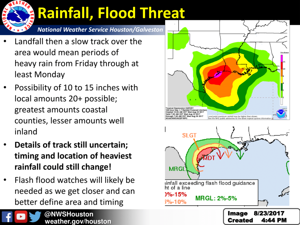
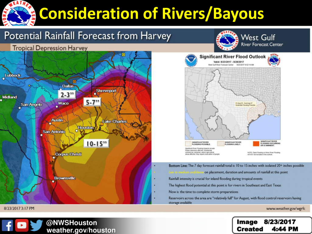
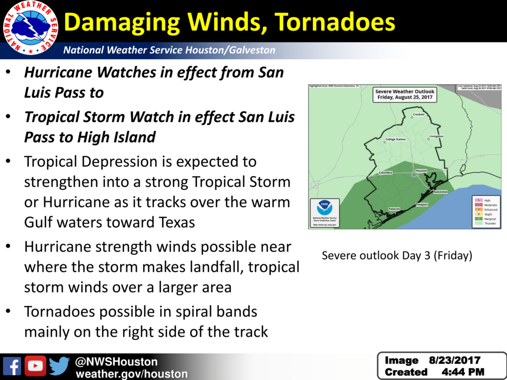
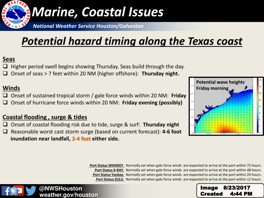
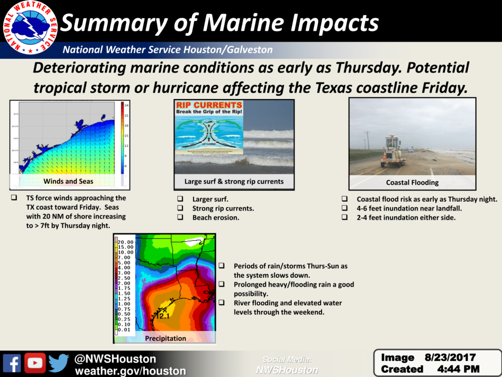
Here is the latest information as of 4 PM concerning Tropical Depression Harvey.  Preparations should be under way to prepare for this potential hurricane!  We are most concerned about this storm stalling or meandering over the area for several days after making landfall. This would result in significant rainfall and flooding.

Summary of 4 PM Information

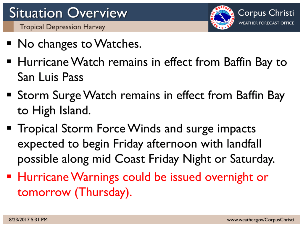
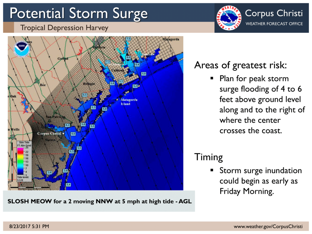
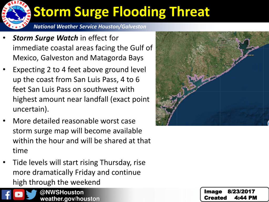
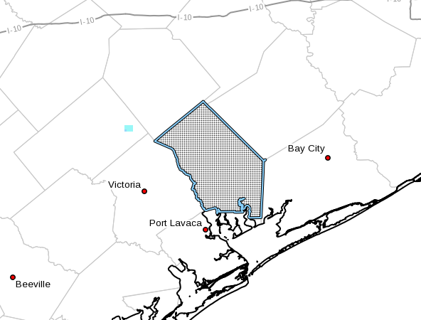
Hurricane Watch remains in effect from Port Mansfield to San Luis Pass including Corpus Christi and surrounding areas

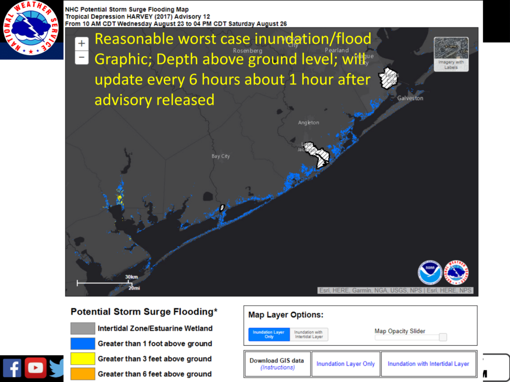
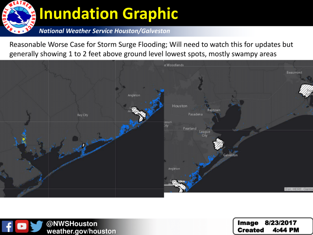
Storm Surge Watch remains in effect from Port Mansfield to High Island including Corpus Christi and surrounding areas

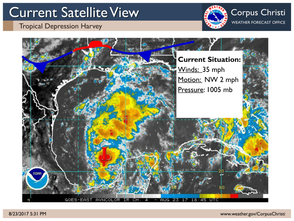
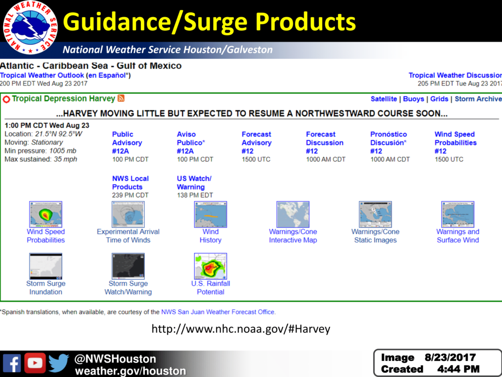
Location: 21.6 N  92.6 W or 525 Miles SSE of Port O’Conner TX

Maximum Sustained Winds: 35 mph
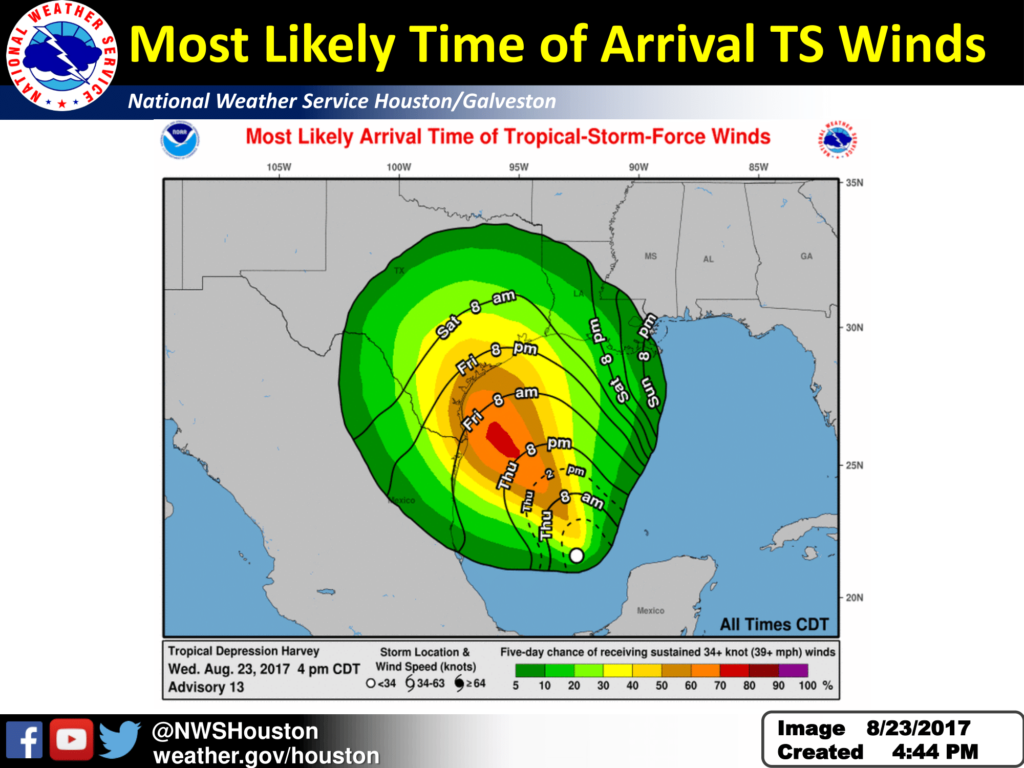
Present Movement:  NW at 2 mph
Minimum Central Pressure:  1005 mb

Additional Information Resources:

National Hurricane Center:
  www.hurricanes.gov
NWS Corpus Christi:  www.weather.gov/corpuschristi
New Local Tropical Webpage:  https://www.weather.gov/srh/tropical?office=crp

Sincerely,
John
NWS Corpus Christi, TX

Tropical Storm Watch for Colorado County, TX

No Comments Local News

…TROPICAL STORM WATCH IN EFFECT…

A Tropical Storm Watch means Tropical storm wind conditions are
possible somewhere within this area and within the next 48 hours

  • WIND
  • LATEST LOCAL FORECAST: Equivalent Tropical Storm force wind
  • Peak Wind Forecast: 30-40 mph with gusts to 50 mph

  • CURRENT THREAT TO LIFE AND PROPERTY: Moderate

  • Emergency planning should include a reasonable threat for
    strong tropical storm force wind of 58 to 73 mph.
  • To be safe, earnestly prepare for the potential of
    significant wind impacts. Efforts should now be underway to
    secure all properties.
  • Dangerous wind is possible. Failure to adequately shelter
    may result in injury.

  • POTENTIAL IMPACTS: Significant

  • Some damage to roofing and siding materials, along with
    damage to porches, awnings, carports, and sheds. A few
    buildings experiencing window, door, and garage door
    failures. Mobile homes damaged, especially if unanchored.
    Unsecured lightweight objects become dangerous projectiles.
  • Several large trees snapped or uprooted, but with greater
    numbers in places where trees are shallow rooted. Several
    fences and roadway signs blown over.
  • Some roads impassable from large debris, and more within
    urban or heavily wooded places. A few bridges, causeways,
    and access routes impassable.
  • Scattered power and communications outages, but more
    prevalent in areas with above ground lines.

  • FLOODING RAIN

  • LATEST LOCAL FORECAST:
  • Peak Rainfall Amounts: 6-10 inches, with locally higher
    amounts

  • CURRENT THREAT TO LIFE AND PROPERTY: Elevated

  • Emergency planning should include a reasonable threat for
    minor flooding where peak rainfall totals are near amounts
    conducive for localized flash flooding and rapid inundation.
  • To be safe, prepare for the potential of limited flooding
    rain impacts.
  • Localized flooding is possible. If flood related watches
    and warnings are issued, heed recommended actions.

  • POTENTIAL IMPACTS: Limited

  • Localized rainfall flooding may prompt a few evacuations.
  • Rivers and tributaries may quickly rise with swifter
    currents. Small streams, creeks, canals, and ditches may
    become swollen and overflow in spots.
  • Flood waters can enter a few structures, especially in
    usually vulnerable spots. A few places where rapid ponding
    of water occurs at underpasses, low-lying spots, and poor
    drainage areas. Several storm drains and retention ponds
    become near-full and begin to overflow. Some brief road and
    bridge closures.

  • TORNADO

  • LATEST LOCAL FORECAST:
  • Situation is favorable for isolated tornadoes

  • CURRENT THREAT TO LIFE AND PROPERTY: None

  • Emergency planning need not include a threat for tornadoes.
    Showers and thunderstorms with strong gusty winds may still
    occur.
  • Little to no preparations needed to guard against tropical
    tornadoes.
  • Ensure readiness for the next tropical tornado event.

  • POTENTIAL IMPACTS: Little to None

  • Little to no potential impacts from tornadoes.

Tropical Storm Watch for Fayette County, TX

No Comments Local News

…TROPICAL STORM WATCH IN EFFECT…

A Tropical Storm Watch means Tropical storm wind conditions are
possible somewhere within this area and within the next 48 hours

  • LOCATIONS AFFECTED
  • La Grange

  • WIND

  • LATEST LOCAL FORECAST: Below tropical storm force wind
  • Peak Wind Forecast: 25-35 mph with gusts to 50 mph

  • CURRENT THREAT TO LIFE AND PROPERTY: Moderate

  • Emergency planning should include a reasonable threat for
    strong tropical storm force wind of 58 to 73 mph.
  • To be safe, earnestly prepare for the potential of
    significant wind impacts. Efforts should now be underway to
    secure all properties.
  • Dangerous wind is possible. Failure to adequately shelter
    may result in injury.

  • POTENTIAL IMPACTS: Significant

  • Some damage to roofing and siding materials, along with
    damage to porches, awnings, carports, and sheds. A few
    buildings experiencing window, door, and garage door
    failures. Mobile homes damaged, especially if unanchored.
    Unsecured lightweight objects become dangerous projectiles.
  • Several large trees snapped or uprooted, but with greater
    numbers in places where trees are shallow rooted. Several
    fences and roadway signs blown over.
  • Some roads impassable from large debris, and more within
    urban or heavily wooded places. A few bridges, causeways,
    and access routes impassable.
  • Scattered power and communications outages, but more
    prevalent in areas with above ground lines.

  • FLOODING RAIN

  • LATEST LOCAL FORECAST:
  • Peak Rainfall Amounts: Additional 4-8 inches, with locally
    higher amounts

  • CURRENT THREAT TO LIFE AND PROPERTY: Elevated

  • Emergency planning should include a reasonable threat for
    minor flooding where peak rainfall totals are near amounts
    conducive for localized flash flooding and rapid inundation.
  • To be safe, prepare for the potential of limited flooding
    rain impacts.
  • Localized flooding is possible. If flood related watches
    and warnings are issued, heed recommended actions.

  • POTENTIAL IMPACTS: Limited

  • Localized rainfall flooding may prompt a few evacuations.
  • Rivers and tributaries may quickly rise with swifter
    currents. Small streams, creeks, canals, arroyos, and
    ditches may become swollen and overflow in spots.
  • Flood waters can enter a few structures, especially in
    usually vulnerable spots. A few places where rapid ponding
    of water occurs at underpasses, low-lying spots, and poor
    drainage areas. Several storm drains and retention ponds
    become near-full and begin to overflow. Some brief road and
    bridge closures.

  • TORNADO

  • LATEST LOCAL FORECAST:
  • Situation is unfavorable for tornadoes

  • CURRENT THREAT TO LIFE AND PROPERTY: None

  • Emergency planning need not include a threat for tornadoes.
    Showers and thunderstorms with strong gusty winds may still
    occur.
  • Little to no preparations needed to guard against tropical
    tornadoes.
  • Ensure readiness for the next tropical tornado event.

  • POTENTIAL IMPACTS: Little to None

  • Little to no potential impacts from tornadoes.

Hurricane Watch & Storm Surge Watch from 8/23/2017 10:14 AM CDT until further notice for Jackson County.

No Comments Local News

…HURRICANE WATCH IN EFFECT…
…STORM SURGE WATCH IN EFFECT…

A Hurricane Watch means Hurricane wind conditions are possible
somewhere within this area and within the next 48 hours

A Storm Surge Watch means life-threatening inundation levels are
possible somewhere within this area and within the next 48 hours

  • WIND
  • LATEST LOCAL FORECAST: Equivalent Tropical Storm force wind
  • Peak Wind Forecast: 35-45 mph with gusts to 55 mph
  • Window for Tropical Storm force winds: Friday morning until
    Saturday afternoon

  • CURRENT THREAT TO LIFE AND PROPERTY: Moderate

  • Emergency planning should include a reasonable threat for
    strong tropical storm force wind of 58 to 73 mph.
  • To be safe, earnestly prepare for the potential of
    significant wind impacts. Efforts should now be underway to
    secure all properties.
  • Dangerous wind is possible. Failure to adequately shelter
    may result in injury.

  • POTENTIAL IMPACTS: Significant

  • Some damage to roofing and siding materials, along with
    damage to porches, awnings, carports, and sheds. A few
    buildings experiencing window, door, and garage door
    failures. Mobile homes damaged, especially if unanchored.
    Unsecured lightweight objects become dangerous projectiles.
  • Several large trees snapped or uprooted, but with greater
    numbers in places where trees are shallow rooted. Several
    fences and roadway signs blown over.
  • Some roads impassable from large debris, and more within
    urban or heavily wooded places. A few bridges, causeways,
    and access routes impassable.
  • Scattered power and communications outages, but more
    prevalent in areas with above ground lines.

  • STORM SURGE

  • LATEST LOCAL FORECAST: Life-threatening storm surge possible
  • Peak Storm Surge Inundation: The potential for 4-6 feet
    above ground somewhere within surge prone areas
  • Window of concern: Begins Friday morning

  • CURRENT THREAT TO LIFE AND PROPERTY: Moderate

  • Emergency planning should include a reasonable threat for
    dangerous storm surge flooding of greater than 3 feet above
    ground.
  • To be safe, earnestly prepare for the potential of
    significant storm surge flooding impacts. Evacuation
    efforts should now be underway.
  • Life-threatening inundation is possible. Failure to heed
    evacuation orders may result in serious injury or loss of
    life. Leave if evacuation orders are given for your area.
    Consider voluntary evacuation if recommended. Poor
    decisions may needlessly risk lives.

  • POTENTIAL IMPACTS: Significant

  • Areas of inundation with storm surge flooding accentuated
    by waves. Damage to several buildings, mainly near the
    coast.
  • Sections of near-shore escape routes and secondary roads
    become weakened or washed out, especially in usually
    vulnerable low spots.
  • Major beach erosion with heavy surf breaching dunes. Strong
    and numerous rip currents.
  • Moderate damage to marinas, docks, boardwalks, and piers.
    Several small craft broken away from moorings, especially
    in unprotected anchorages.

  • FLOODING RAIN

  • LATEST LOCAL FORECAST:
  • Peak Rainfall Amounts: 8-12 inches, with locally higher
    amounts

  • CURRENT THREAT TO LIFE AND PROPERTY: Elevated

  • Emergency planning should include a reasonable threat for
    minor flooding where peak rainfall totals are near amounts
    conducive for localized flash flooding and rapid inundation.
  • To be safe, prepare for the potential of limited flooding
    rain impacts.
  • Localized flooding is possible. If flood related watches
    and warnings are issued, heed recommended actions.

  • POTENTIAL IMPACTS: Limited

  • Localized rainfall flooding may prompt a few evacuations.
  • Rivers and tributaries may quickly rise with swifter
    currents. Small streams, creeks, canals, and ditches may
    become swollen and overflow in spots.
  • Flood waters can enter a few structures, especially in
    usually vulnerable spots. A few places where rapid ponding
    of water occurs at underpasses, low-lying spots, and poor
    drainage areas. Several storm drains and retention ponds
    become near-full and begin to overflow. Some brief road and
    bridge closures.

  • TORNADO

  • LATEST LOCAL FORECAST:
  • Situation is favorable for isolated tornadoes

  • CURRENT THREAT TO LIFE AND PROPERTY: None

  • Emergency planning need not include a threat for tornadoes.
    Showers and thunderstorms with strong gusty winds may still
    occur.
  • Little to no preparations needed to guard against tropical
    tornadoes.
  • Ensure readiness for the next tropical tornado event.

  • POTENTIAL IMPACTS: Little to None

  • Little to no potential impacts from tornadoes.