

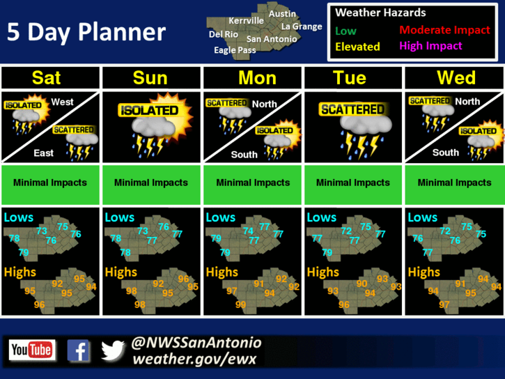
There will be multiple days with rain chances through Wednesday. Most of the rains will be spotty and light, however occasional heavy downpours of 1 to 2 inches will be possible in isolated locations each day. Temperatures will be below normal throughout the period. Afternoon heat index values of 104 to 108 degrees will be possible Sunday through Tuesday across portions of South Central Texas, outside of the Hill Country.
Today
Mostly cloudy with a 40 percent chance of showers and thunderstorms. Highs in the mid 90s. North winds 5 mph shifting to the east in the afternoon. Highest heat index readings around 105.
Tonight
Partly cloudy with a 20 percent chance of showers and thunderstorms. Lows in the mid 70s. Southeast winds 5 to 10 mph.
Saturday
Mostly cloudy with a 40 percent chance of showers and thunderstorms. Highs in the lower 90s. Southeast winds 10 to 15 mph. Highest heat index readings around 106.
Saturday Night
Partly cloudy before midnight then becoming mostly cloudy. A 20 percent chance of showers and thunderstorms. Lows in the upper 70s. South winds 10 to 15 mph.
Sunday
Mostly cloudy with a 40 percent chance of showers and thunderstorms. Highs in the lower 90s. South winds 10 to 15 mph. Highest heat index readings around 106.
Sunday Night
Mostly cloudy with a 30 percent chance of showers and thunderstorms. Lows in the upper 70s.


Comments are closed.