

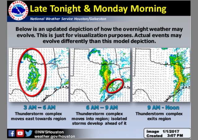
Overview: Scattered thunderstorms are expected to develop across parts of West and West Central Texas tonight and grow into a large thunderstorm complex that will move from west to east across the state. Ahead of this complex, isolated showers and thunderstorms may develop across Southeast Texas that pose a damaging wind or brief tornado threat before the main thunderstorm complex moves across the region. This complex will move quickly east, with dry and warm conditions expected across the region after 12 PM.
While the thunderstorm complex will be capable of heavy rain, the speed at which it moves across the region will minimize any flooding threat these storms pose.
Changes Since Last Briefing: Minor refinements to timing and impacted locations
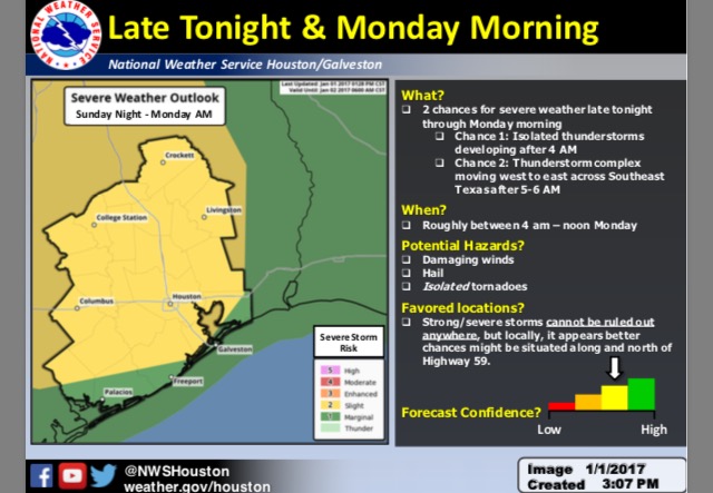
Hazards: Thunderstorms capable of damaging winds, hail, and isolated tornadoes
Timing: 4 AM – Noon Monday (Travel impacts during the morning commute possible)
Location: Severe weather will be possible across most of Southeast Texas tonight into
Monday morning, with best potential at this time appearing to be north of the Highway 59 corridor.
Melissa Huffman & Josh Lichter
NWS Houston/Galveston
Comments are closed.