
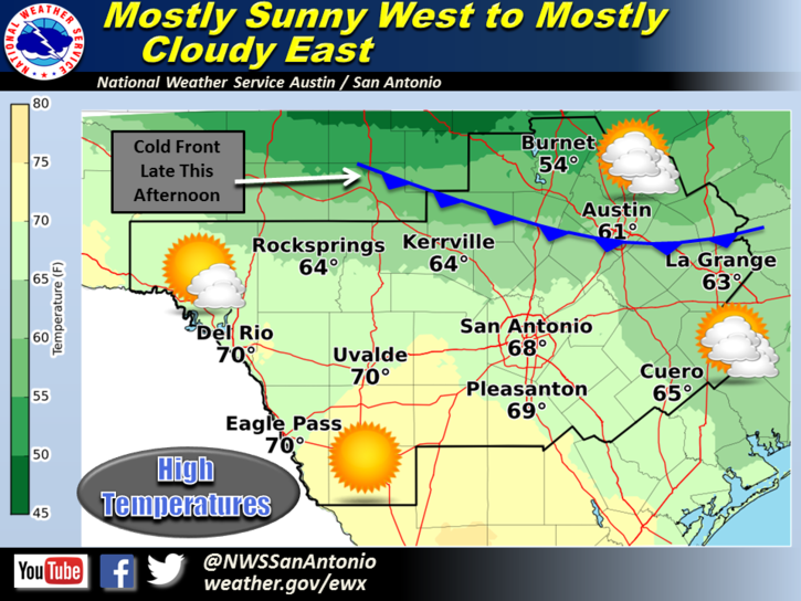
Skies will range from mostly sunny along the Rio Grande to mostly cloudy across the coastal plains today. Temperatures will be warmer compared to yesterday. However, a cold front will move into the region late this afternoon bringing increasing north winds and cooler air to the region. Highs will range from near 70 along the Rio Grande to the mid 50s in the northern Hill Country.
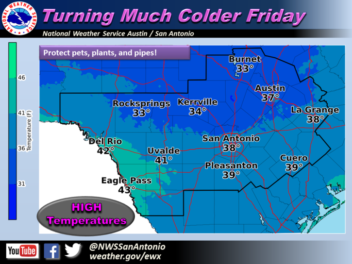
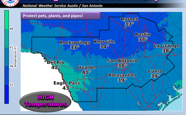
Much colder temperatures can be expected across all of south central Texas beginning Friday and continuing through the upcoming weekend. High temperatures on Friday will remain in the 30s for most areas, except for near 40 along the Rio Grande. A freeze is expected across all areas Friday night and again Saturday night. The coldest temperatures are expected across the Hill Country where a hard freeze is in store with overnight lows near 20 degrees both nights. Wind chills will be in the teens and twenties for most areas Friday, Saturday and Sunday mornings.
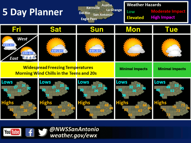
Much colder temperatures are in store for the end of the work week through the upcoming weekend across south central Texas. Widespread freezes are in store along with morning wind chills in the teens and 20s Friday through Sunday. There is a slight chance of light rain across the coastal plains and Highway 77 corridor on Friday, but temperatures are currently expected to be above freezing during this period of possible precipitation. A warming trend is expected for early next week.
Now, here’s your Texas Thunder Radio Weather from the National Weather Service in Austin/San Antonio:
Tonight: Colder. Mostly cloudy. Lows in the mid 30s. North winds 15 to 20 mph with gusts to around 30 mph.
Friday: Much colder. Cloudy with a 20 percent chance of rain. Highs in the upper 30s. North winds 15 to 20 mph.
Friday Night: Mostly cloudy before midnight then becoming partly cloudy. Lows in the upper 20s. North winds 10 to 15 mph with gusts to around 25 mph. Wind chill readings 20 to 25.
Saturday: Partly cloudy in the morning then becoming sunny. Highs in the lower 40s. North winds 10 to 15 mph. Lowest wind chill readings 20 to 25 in the morning.
Saturday Night And Sunday: Clear. Lows in the upper 20s. Highs around 50. Wind chill readings 30 to 35.
Sunday Night And Monday: Warmer. Partly cloudy. Lows in the upper 30s. Highs in the upper 60s.
***For local weather information, visit the TTR Weather Center, powered by NWS Austin-San Antonio.
***For Road Condition Information, visit the TTR Traffic Center, powered by DriveTexas.org.
Stay Warm,
Texas Thunder Radio
Comments are closed.