Home

TTR News Center

NWS Houston – Galveston Update: Monitoring Gulf of Mexico for Possible Development, No Current Threat to Texas

No Comments Local News

Good afternoon,
Bottom Line

The tropics remain active this afternoon and are expected to remain active over the next week. While we are currently monitoring Hurricane Irma, an area of low pressure in the Bay of Campeche, and a wave in the central Atlantic, none of these systems pose a threat to Southeast Texas at this time.

Overview
Generally dry conditions are expected through the remainder of today, with isolated to scattered showers possible Tuesday into early Wednesday along and ahead of a cold front moving off the area. This cold front is expected to sweep off the Upper Texas coast Wednesday morning and push the area of low pressure in the Bay of Campeche into Mexico, with no impacts expected in Southeast Texas at this time.

Hurricane Irma continues to approach the Leeward Islands this afternoon and is expected to move west to west-northwest towards Florida over the next few days. No impacts are expected in Southeast Texas from Hurricane Irma at this time.

Resources
Melissa Huffman
National Weather Service – Houston/Galveston, TX
Twitter: @NWSHouston
Facebook: NWSHouston

Update from LCRA: Lakes Bastrop and Fayette closed

No Comments Local News

  • LCRA has closed lakes Bastrop and Fayette to recreational boating because of dangerous conditions caused by Hurricane Harvey.
  • LCRA is closely monitoring the storm and has staff on duty round-the-clock at the River Operations Center and each of the dams along the Highland Lakes in case floodgate operations are needed.
  • See the LCRA Hydromet for rainfall totals, lake levels and streamflow throughout the lower Colorado River basin.
  • Matagorda Bay Nature Park, Oak Thicket Park and Park Prairie also are closed. For more information, see the LCRA Park Alerts page.


Clara Tuma
Lower Colorado River Authority | Public Information Officer 

NWS HOUSTON-GALVESTON (COLORADO, JACKSON, WHARTON COUNTIES) Update on Hurricane Harvey.

No Comments Local News

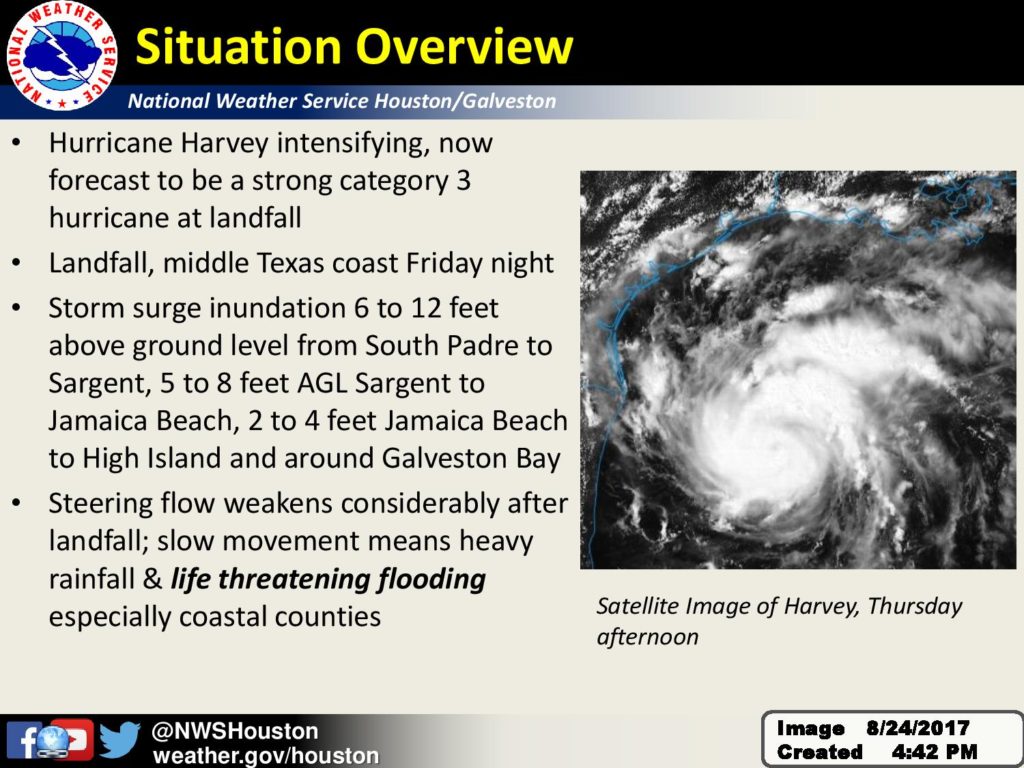
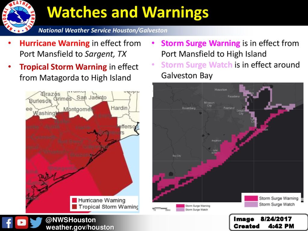
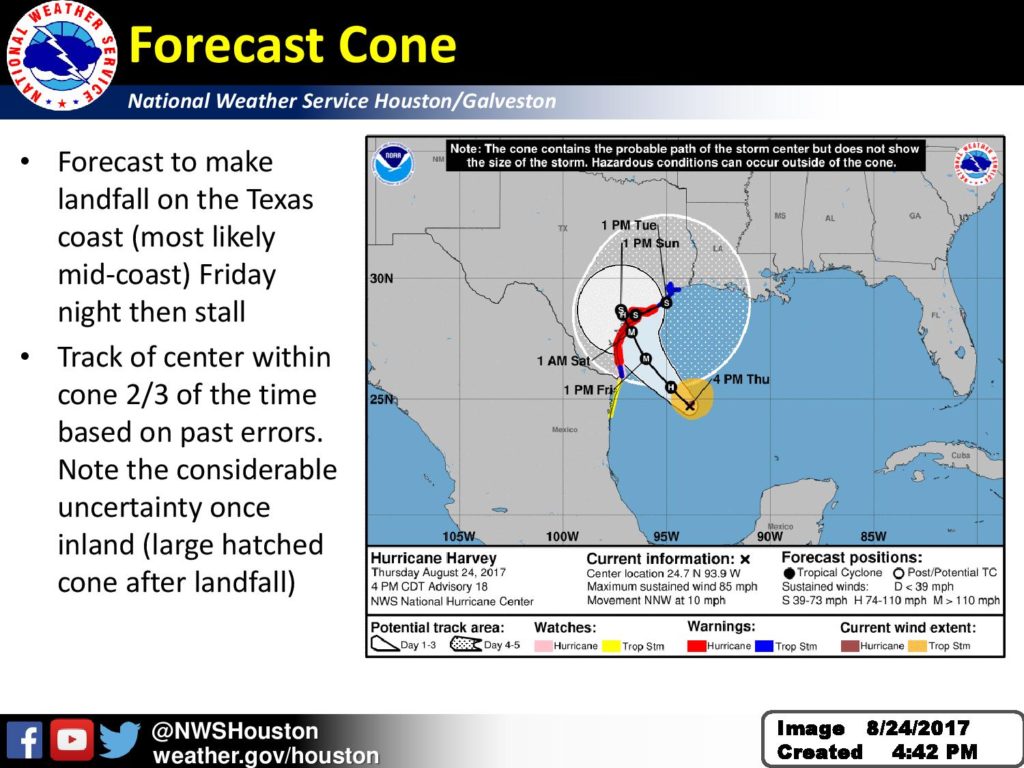
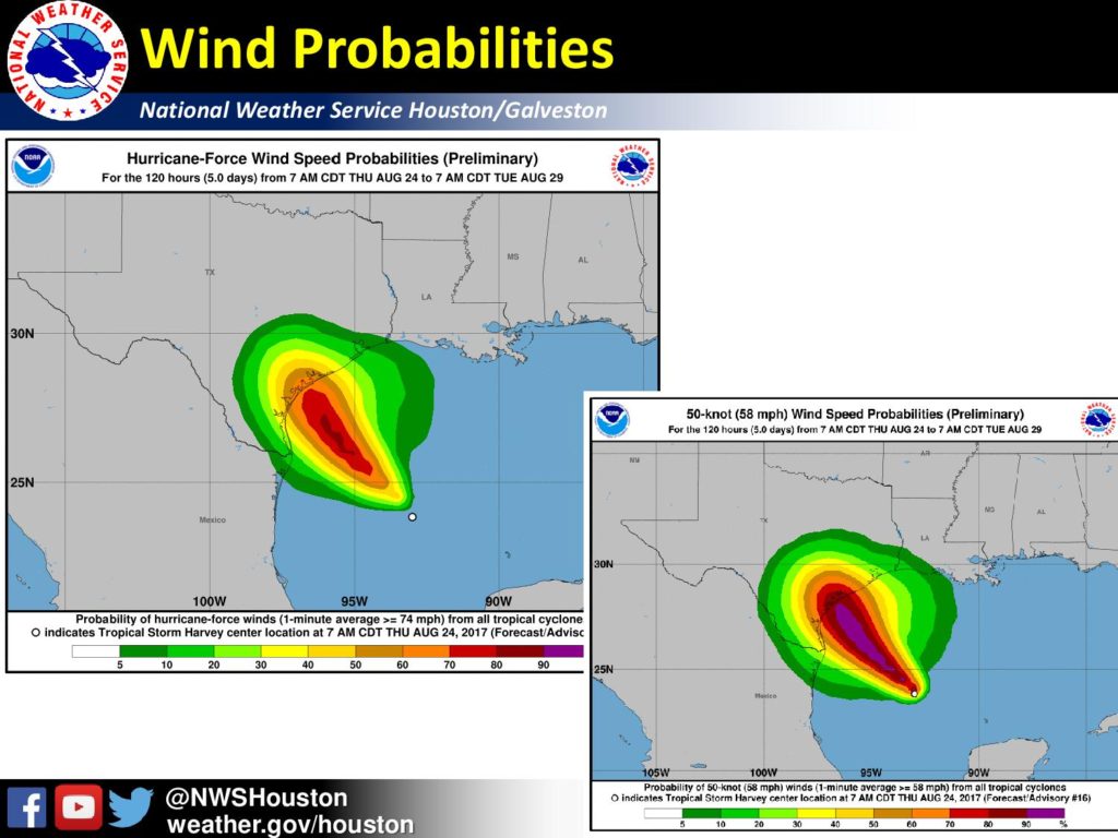
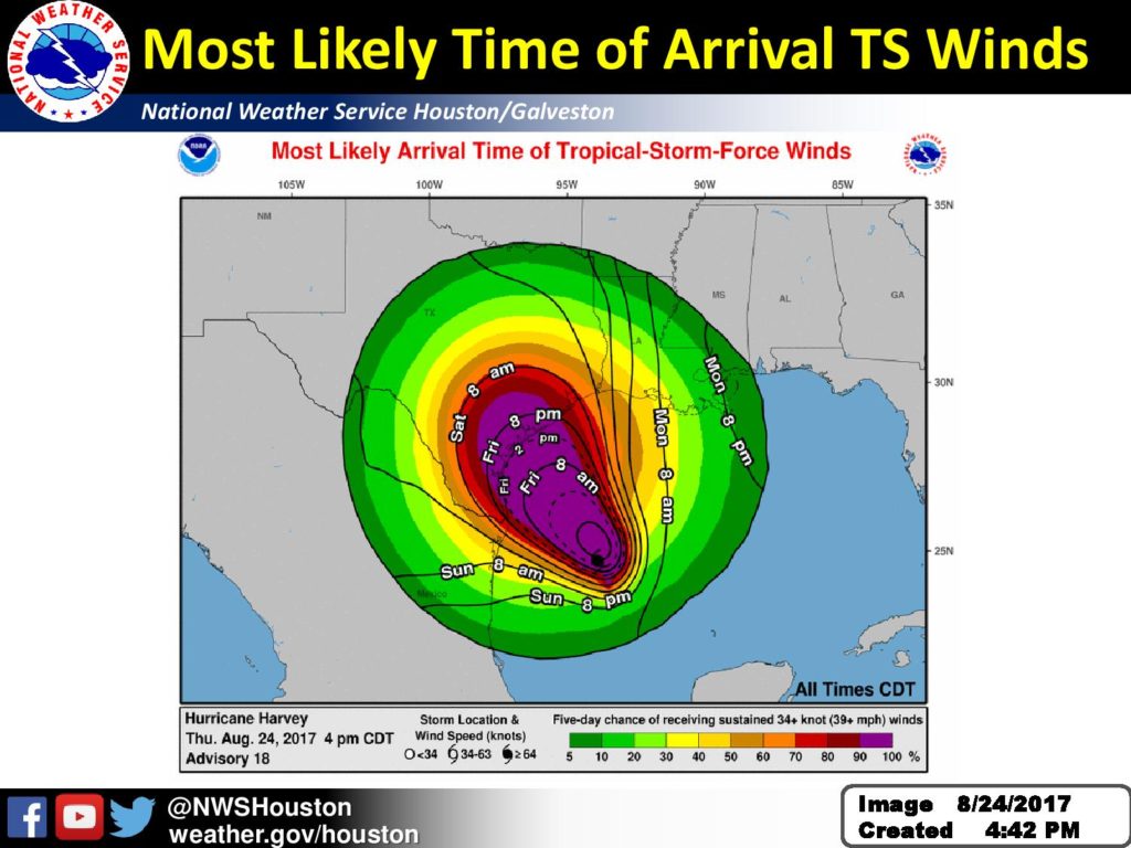
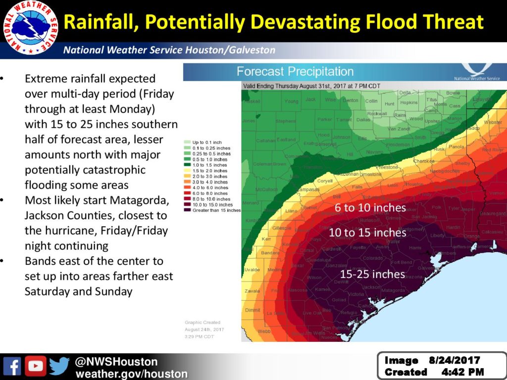
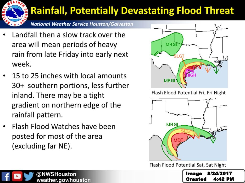
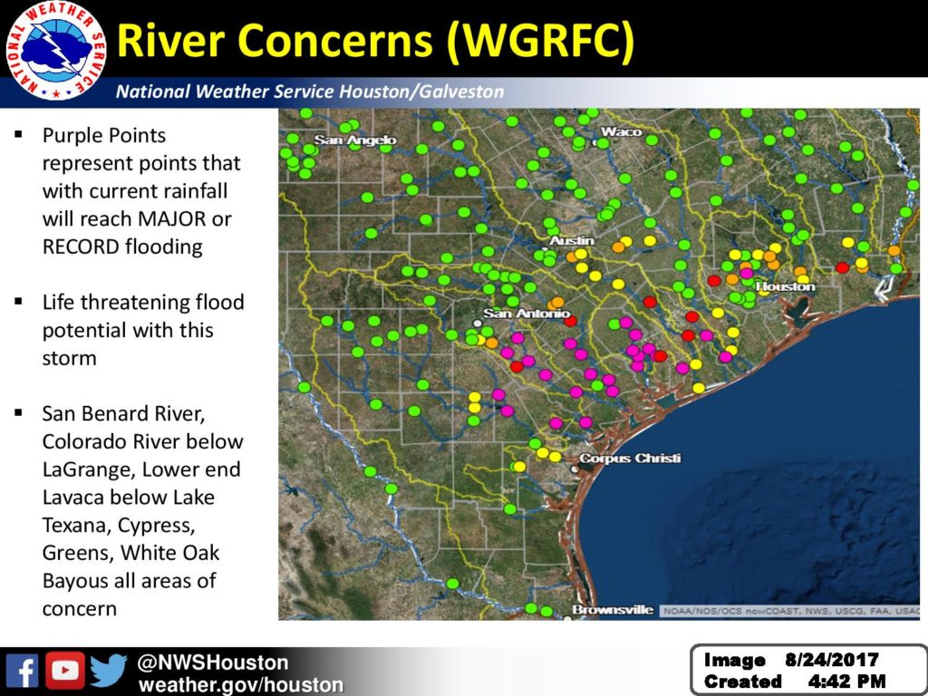
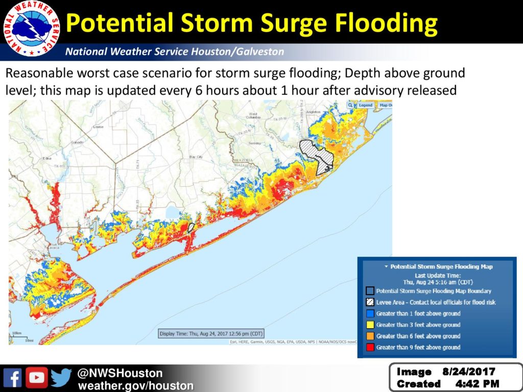
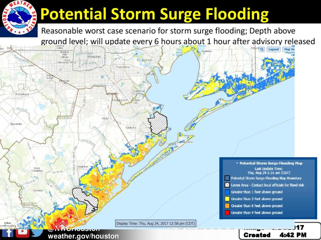
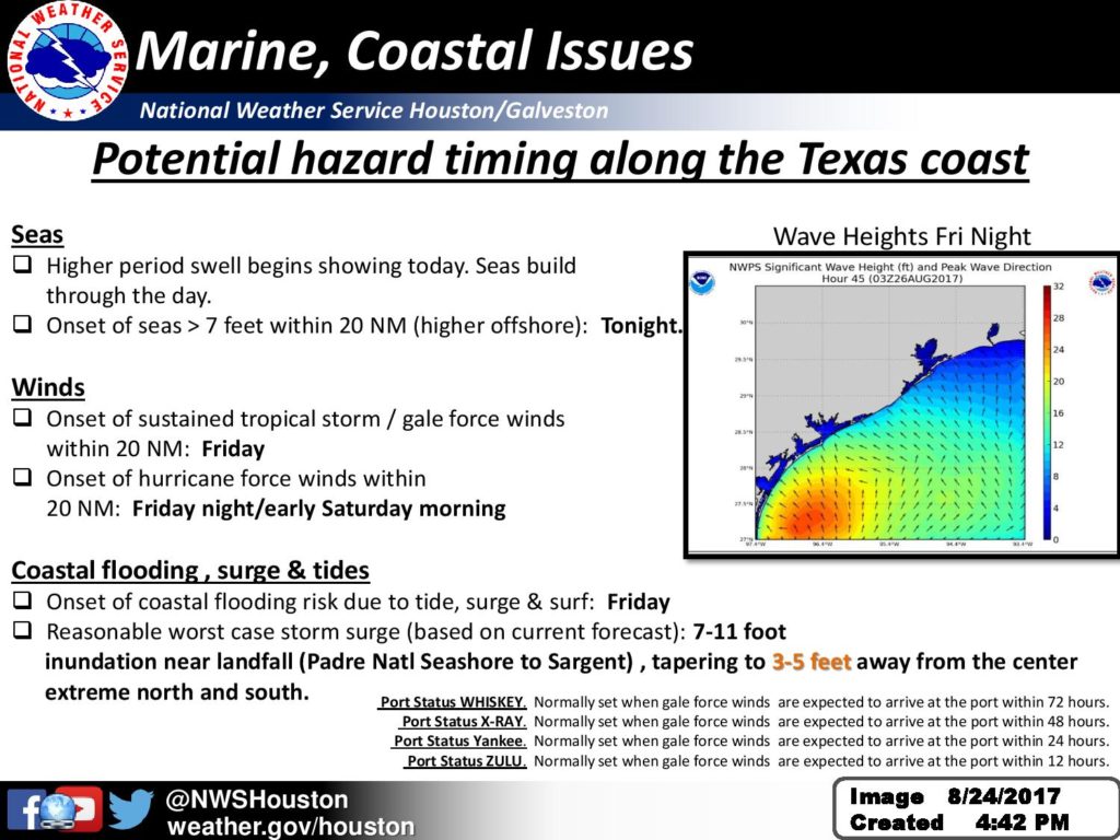
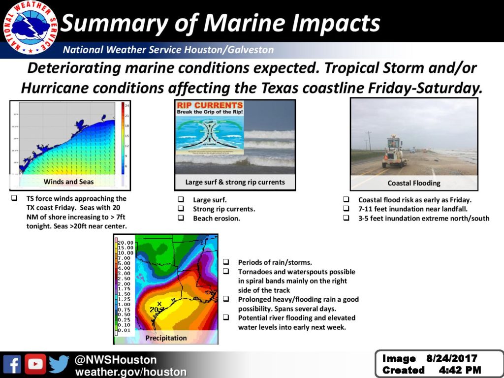
Harvey, now a hurricane, has the potential to become a major category 3 hurricane before landfall. Extremely high rainfall amounts could lead to a catastrophic flood event some areas. Life threatening storm surge and winds possible as well especially down the coast toward Matagorda, Jackson and Brazoria Counties. See attached for details.

— 
Dan Reilly
Warning Coordination Meteorologist
National Weather Service Houston/Galveston

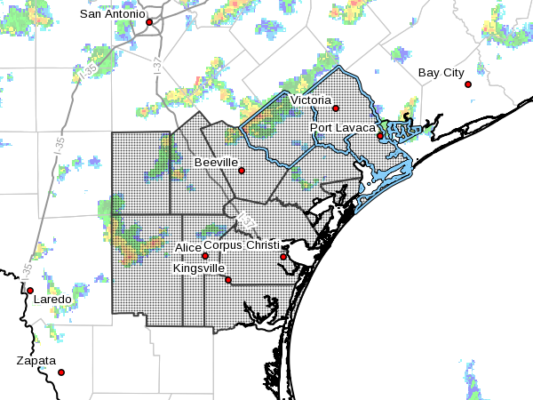
Flash Flood Watch from 8/25/2017 4:00 AM to 8/28/2017 7:00 AM CDT for Victoria County, Calhoun County, Goliad County.

No Comments Local News

McMullen-Live Oak-Bee-Goliad-Victoria-Duval-Jim Wells-Kleberg-
Nueces-San Patricio-Aransas-Refugio-Calhoun-
Including the cities of Calliham, Cross, Loma Alta, Tilden,
George West, Three Rivers, Beeville, Goliad, Victoria, Freer,
Benavides, San Diego, Alice, Orange Grove, Kingsville,
Corpus Christi, Portland, Ingleside, Aransas Pass, Sinton,
Mathis, Rockport, Refugio, Woodsboro, and Port Lavaca
444 PM CDT Thu Aug 24 2017
 
…FLASH FLOOD WATCH NOW IN EFFECT FROM 4 AM CDT FRIDAY THROUGH
MONDAY MORNING…
 
The Flash Flood Watch is now in effect for
 
* A portion of South Texas, including the following areas,
Aransas, Bee, Calhoun, Duval, Goliad, Jim Wells, Kleberg, Live
Oak, McMullen, Nueces, Refugio, San Patricio, and Victoria.
 
* From 4 AM CDT Friday through Monday morning
 
* Heavy rains from Harvey will impact much of South Texas late
this week into the weekend. A prolonged heavy rain and flash
flood threat may evolve over parts of the area. The heaviest
rains are most likely to occur east of Interstate 37. Rainfall
amounts between 15 to 25 inches is expected with isolated
higher amounts up to 35 inches possible. Lower rainfall amounts
will occur further to the south and west, but significant
flooding will still be possible.
 
 
PRECAUTIONARY/PREPAREDNESS ACTIONS…
 
A Flash Flood Watch means that conditions may develop that lead
to flash flooding. Flash flooding is a VERY DANGEROUS SITUATION.
 
You should monitor later forecasts and be prepared to take action
should Flash Flood Warnings be issued.

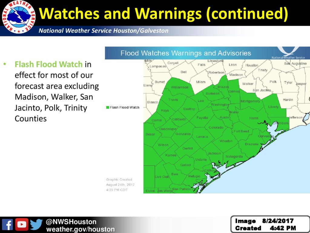
…FLASH FLOOD WATCH NOW IN EFFECT FROM 4 AM CDT FRIDAY THROUGH MONDAY MORNING FOR COLORADO AND JACKSON COUNTIES…

No Comments Local News

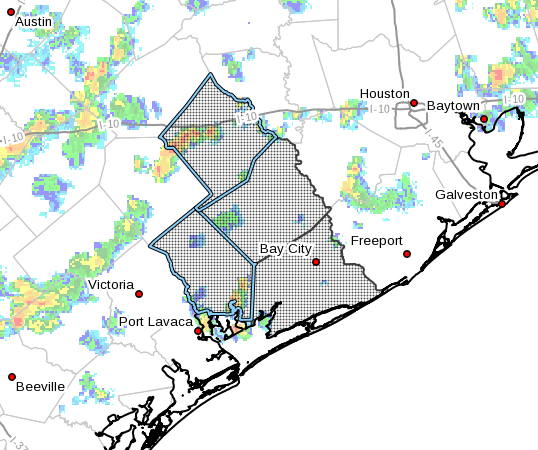
Flash Flood Watch for Jackson, TX, Colorado, TX
 
Colorado-Jackson-Matagorda-Wharton-
Including the cities of Bay City, Columbus, Eagle Lake, Edna,
El Campo, Palacios, Pierce, Weimar, and Wharton
438 PM CDT Thu Aug 24 2017
 
…FLASH FLOOD WATCH NOW IN EFFECT FROM 4 AM CDT FRIDAY THROUGH
MONDAY MORNING…
 
The Flash Flood Watch is now in effect for
 
* Portions of Southeast Texas and southeast Texas…including
the following counties…in Southeast Texas…Jackson. In
southeast Texas…Colorado…Matagorda and Wharton.
 
* From 4 AM CDT Friday through Monday morning
 
* Rainfall from Harvey will cause devastating and life-
threatening flooding as a prolonged heavy rain and flash flood
threat is expected to occur. Rainfall rates of 4 inches per hour
or more will lead to flash flooding as rain squalls from Harvey
begin to become more numerous Friday morning along the coast and
then spread inland Friday night and Saturday. Periods of heavy
rainfall are then expected from Harvey or its remnants through
Monday morning.
 
* It is possible that additional Southeast Texas counties will be
added to the Flash Flood Watch as this event unfolds, and the
Flash Flood Watch itself could be extended beyond Monday
morning.
 
* It is possible that additional Southeast Texas counties will
be added to the Flash Flood Watch as this event unfolds, and
the Flash Flood Watch itself could be extended beyond Sunday
morning.
 
PRECAUTIONARY/PREPAREDNESS ACTIONS…
 
A Flash Flood Watch means that conditions may develop that lead
to flash flooding. Flash flooding is a very dangerous situation.
 
You should monitor later forecasts and be prepared to take action
should Flash Flood Warnings be issued.