 ABC NewsBy MAX GOLEMBO, ABC News
(NEW YORK) — The National Oceanic and Atmospheric Administration (NOAA) Prediction Center issued a rare high risk for severe thunderstorms that could produce intense, long-track tornadoes, huge hail and damaging straight-line winds.
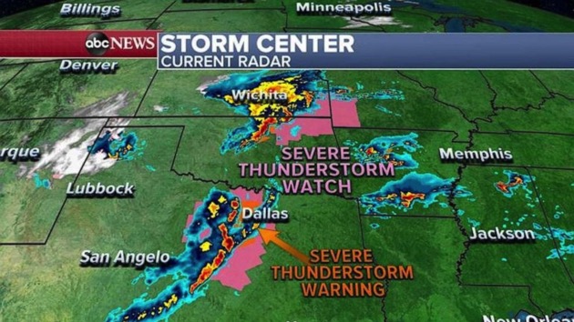
On Wednesday morning, storms are already moving through Texas, Oklahoma and Kansas with severe thunderstorm watches and warnings for damaging winds and large hail.
The same line of storms that is moving through Texas this morning is expected to intensify as it moves east into the Gulf Coast states as supercell thunderstorms will fire up and are expected to produce dangerous large tornadoes, straight-line winds over 70 mph and huge hail.
The biggest threat for these storms today will be from northern Louisiana and southern Arkansas through Mississippi and into western Alabama.
The most dangerous part is that these storms will continue to be active through Wednesday night into Thursday morning producing night time tornadoes across the South.
By Thursday afternoon, severe storms will move into the Southeast from Florida to Virginia with the biggest threat for strong tornadoes from Georgia to South and North Carolina.
On the back side of this dangerous storm system there is a blizzard warning for five states, the Texas panhandle, northwestern New Mexico, southern Colorado, the Oklahoma panhandle and southern Kansas and these areas could see wind gusts near 50 mph and up to 7 inches of snow, creating whiteout conditions.
On Wednesday morning, more than a dozen states are under snow, flood and high wind alerts.
Copyright © 2021, ABC Audio. All rights reserved.


Comments are closed.